The Mountain Sea
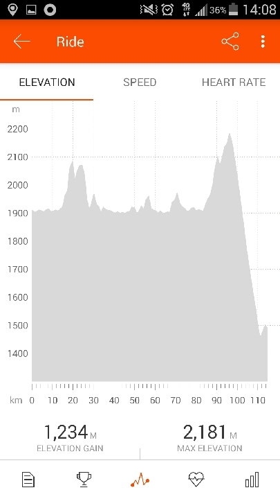
Sutter Creek sits at about 300 m of elevation. Lake Tahoe, 1,800 m. It's surrounded by a rim of mountains, and the highest pass I'd have to cross reaches 2,600 m. The entire day would essentially be one long uphill, followed by 15 km of coasting down to the lake.
After a hearty breakfast and a goodie bag (thanks!), I set of "early," at least by recent standards. 7:30 AM. I should get into the habit of starting closer to 6:00 AM. Right of the bat, uphill, and nothing else.
Two hours later, I'd covered less than 30 km. I stopped at a gas station to put on sunscreen. A curious cop came over and asked what I was up to. He was impressed that I'd made it from Sutter Creek as quickly as I had, but said Tahoe was impossible. According to him, Kirkwood is as far as I could make it, about 45 km shy of Tahoe.
I looked at the map. Kirkwood was almost at the same elevation as the highest pass. If I could make it there, Shirley I could push up one more hill, then coast down to the lake. Right?
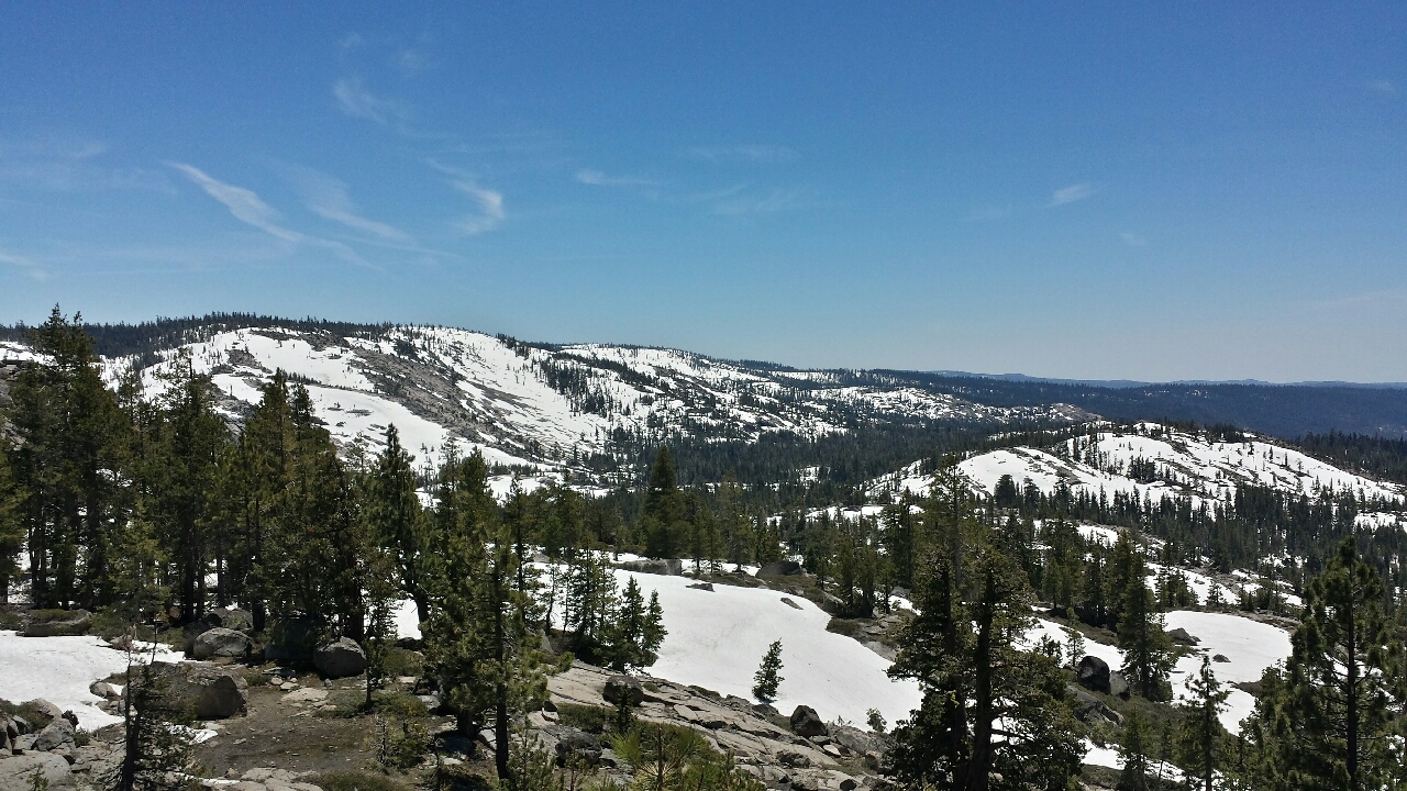
Starting with 3,000 feet, there's a sign marking each 1,000 feet of elevation. Passing each one felt like an accomplishment. On the way up, sweat poured out like my skin was a seive. This was the hottest I'd been on this tour, or on any training rides this spring, even though it wasn't a hot day.
I passed another touring cyclist going the other way. Her name was Judy, and she looked like she was recently retired. She was from Baltimore. I can't remember all the details of her tour, but it went all over the country and was to take about a year. She told me the hills up ahead weren't so bad, because she'd been pedaling most of the time, not coasting.
She was right, for the most part. There were not killer steep sections; the grade, when climbing, was about 5%, in contrast to the double-digit grades in the preceding days. Every so often, there was a flat section, or even a short descent, only to make you do those 100 m of climbing all over again.
After 7,000 feet, it got easier. The flat sections became more frequent, the climbs more spread-out. I intended to stop at a lakeside resort/restaurant to fill up on water, but it was still closed for the winter (in June). I stopped outside anyway and had lunch. I'd have to figure out water later.
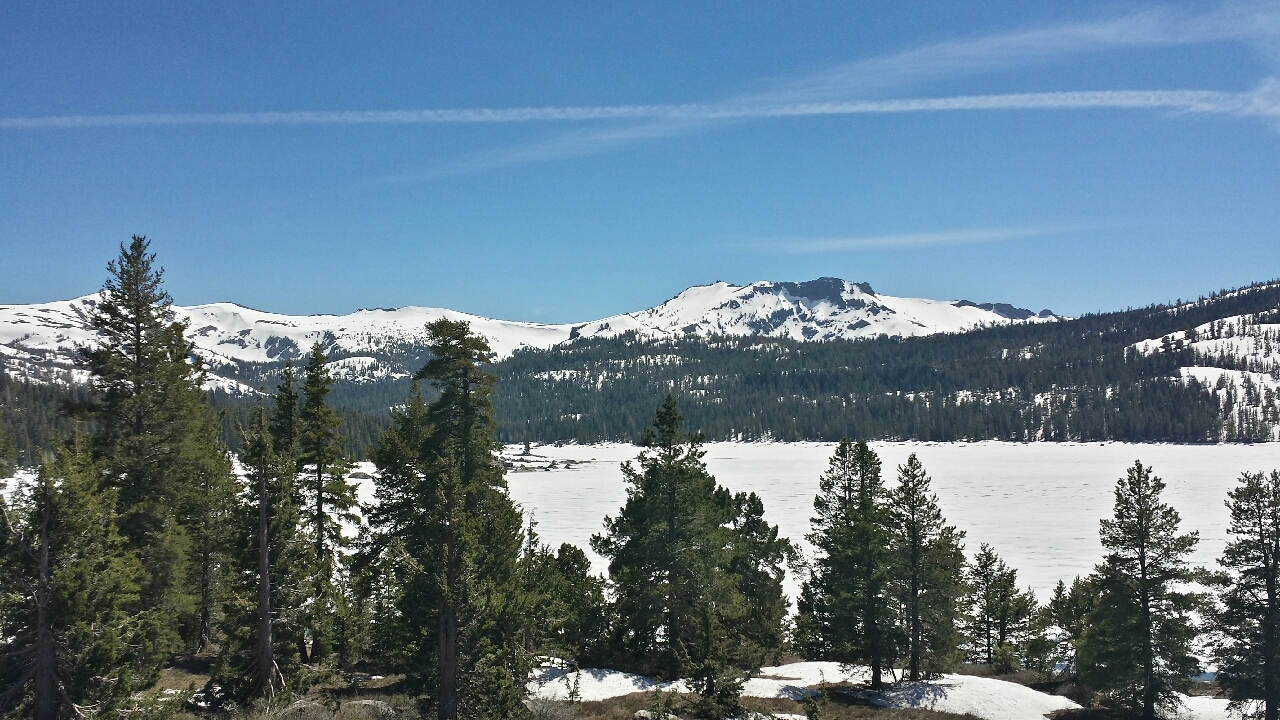
The air was now much cooler, due to the elevation and perhaps also a cooling effect from the piles of snow laying near the road. Made for better riding.
On the last climb up to the pass, I caught up to another touring cyclist, going the same direction for the moment. He was a chef from Park City, UT, but originally from Chicago. He had a Chicago city flag pinned to his front bag, the only decent American city flag that I know of. Try looking up your city's flag. Then look at national flags by comparison. We need to fix this problem, most notably by taking words and seals off of all flags.
Thankfully, this guy had a ton of extra water, more than he needed, and was happy to give some away and weigh less. We reached the pass together, then got separated on the ensuing downhill. I'm still gun-shy about those. We caught up once again before he split off to go to Carson City.
I still had one last pass to cross, then got another long downhill into town. Had to ride a ways around town to reach my host, not that it was so bad on level ground and in the shade.
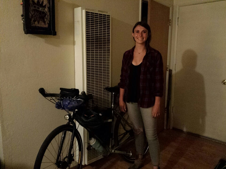
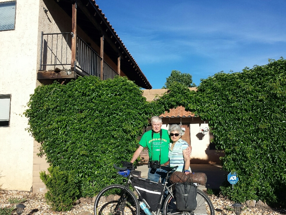
Alyssa is a full-time chemistry student who also works two jobs and goes rock climbing, snowboarding, you name it. It had been her birthday the day before, and today, her work told her to take the night off, giving her a free Friday night for the first time in six months. So for the most part, I had the place to myself, as long as I could share it with what looked like a cross between a Siamese and an orange tabby. She liked to rub on everything.
After a long day, a quiet, relaxing night. Well, almost, if you don't count the party going on in the parking lot outside. But I'll take it.
Carson City, by the most direct route, is at most 50 km from South Lake Tahoe, mostly downhill. I didn't take the most direct route.
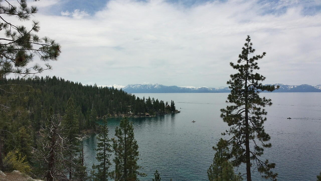
Instead, I went around the lake the wrong way, tripling the distance and adding some hills for good measure. The day started off cold, but once the climb to Emerald Bay began, it felt a lot warmer.
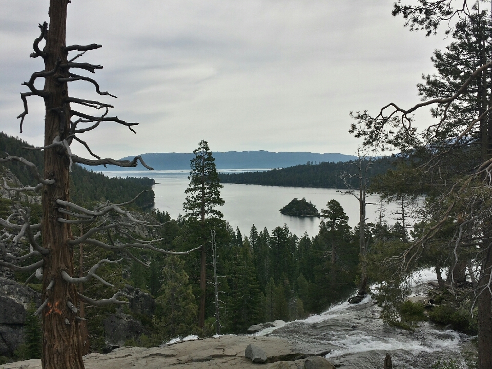
It was cloudy and cool, perfect riding conditions, though made for worse photos. At Emerald Bay, there was a Team In Training group from Pittsburg. Evidently they were on a training ride for an organized bike ride around the lake the next day. They had a support van, and a guy was filling their water for them. I miss that about Texas 4,000. I should pay money and do a supported tour one day. Maybe when I'm older and carrying my stuff has less and less appeal.
The path around the lake was full of rolling hills, but compared to the previous day, they were mere annoyances. There was a separate bike path next to the road, but it was in poor condition (frequent cracks), disappeared and reappeared every 10 km, and frequently crossed the road. It's hard to see the point in keeping a bike path separate from traffic if you're going to make it cross the road every two minutes. Fortunately, there was an on-road bike lane. I used that.
All day, I'd been bracing myself for the climb over the Tahoe Rim, but it wasn't bad! On the way up, a guy handed me a beer. Drinking it then would be a bad idea, so I tucked it in a pannier. My host might appreciate it.
After the climb was over, a screaming downhill into Carson City. Brakes, not pedals. Every 500 m, there was a drainage grate that covered the entire shoulder, forcing you to swerve into a lane of traffic to avoid it in the 1-2 seconds you have to react at that speed. Does the grate have to cover the entire shoulder? Why not make it thinner and longer, and leave part of the shoulder usable?
The land immediately changed from alpine forest to rugged desert. The California-Nevada border is one of the most severe ecological changes is such a short space. Even when you expect it, it can still surprise you.
After reaching the bottom, a few miles into a stiff desert wind and I'd reached my hosts, Tom and Connie Davis. Tom was a high school classmate of my mom's and I guess my dad too, though they didn't know each other at the time.
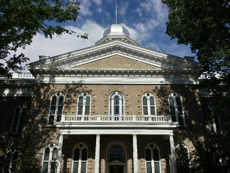
After a shower and a beer, Tom took me to see the state capitol building. Not as big as Texas's or California's, but the ivy on the walls was a nice touch. On the capitol grounds was a statue of Kit Carson, one of the most famous western frontiersmen and the namesake of Carson City.
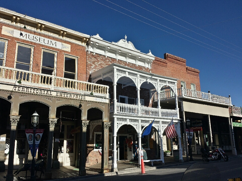
Tom and I then drove up into the hills to visit Virginia City, once a rip-roaring mining town and the largest city in the west. Now, it's mostly known for tourism. It looks mostly the same on the outside, but it's become different on the inside. Probably a lot more family-friendly than it used to be.
Tom and I headed back where Connie had whipped up an excellent and enormous dinner, followed by a homemade rhubarb pie for dessert. Yum! They gave me some invaluable tips for the few days ahead, after which I retired for the evening in their RV.


 June
June

