Passing
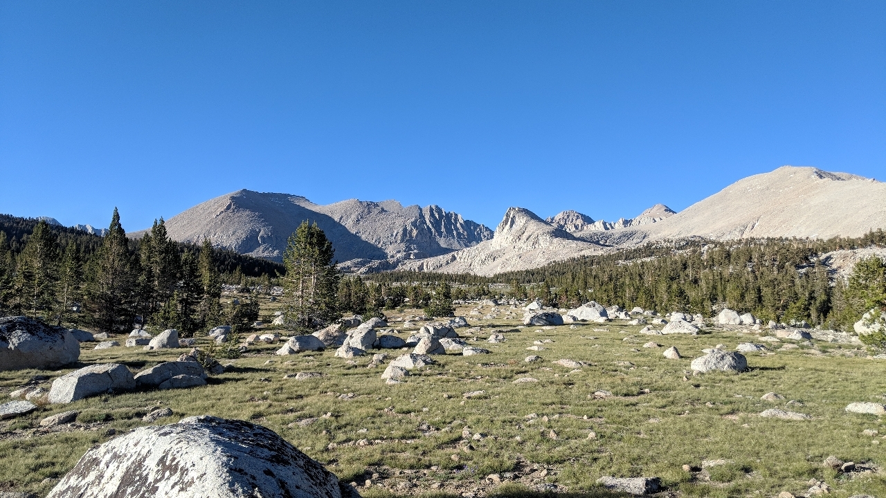
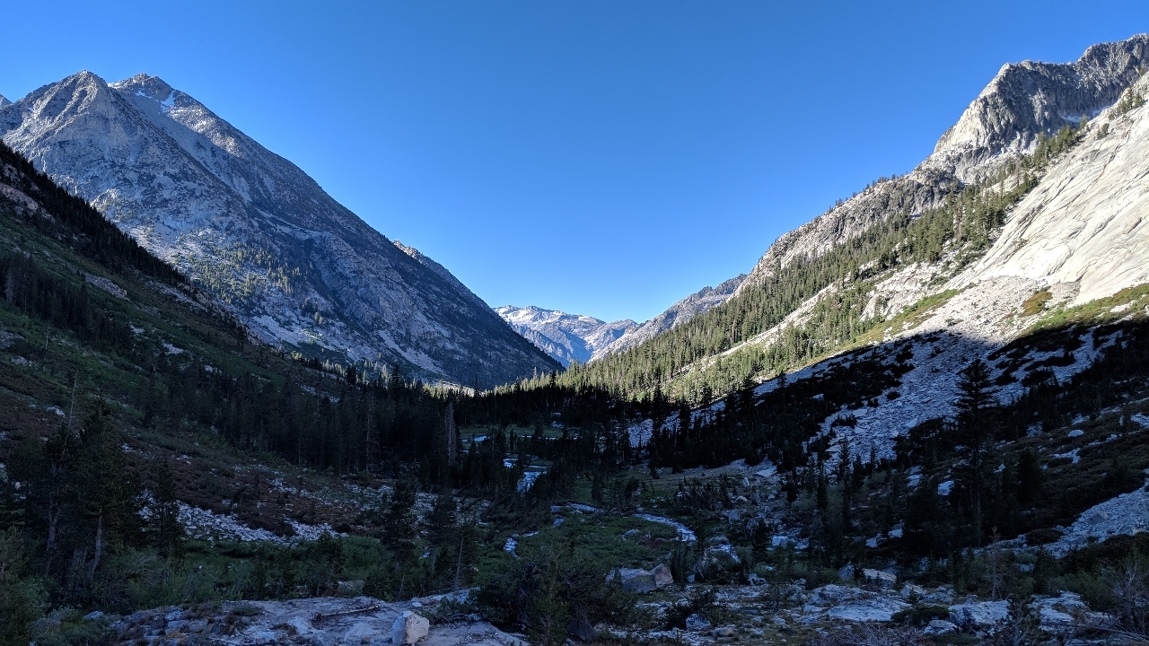
In the High Sierra section of the PCT, the most daunting challenge is the series of passes. By strange coincidence, the highest passes are the farthest south, the first that most hikers get to, and they get shorter as you go. None of them are as high as Mount Whitney, of course, but they're a challenge nonetheless. In some ways, more so.
The consensus would say the terrain will force you to only cross one pass per day, and if you average 25 miles per day, the Sierra will slow you down to no more than 17. Both of those myths have been busted.
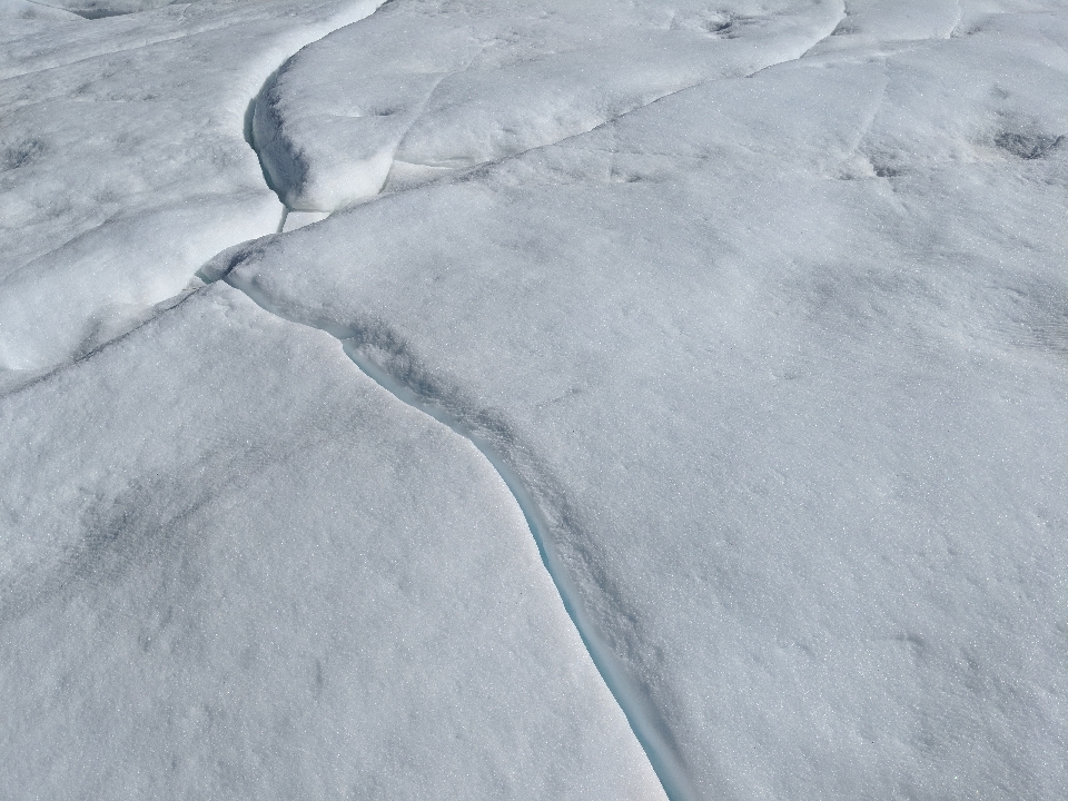
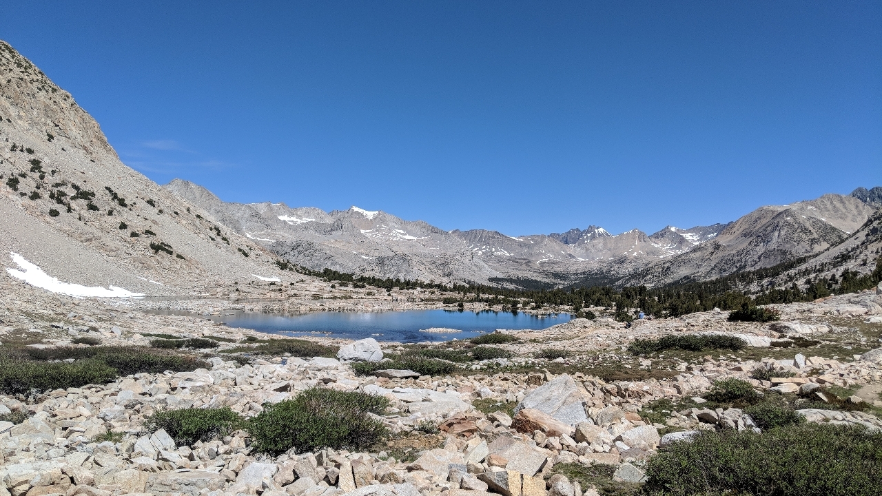
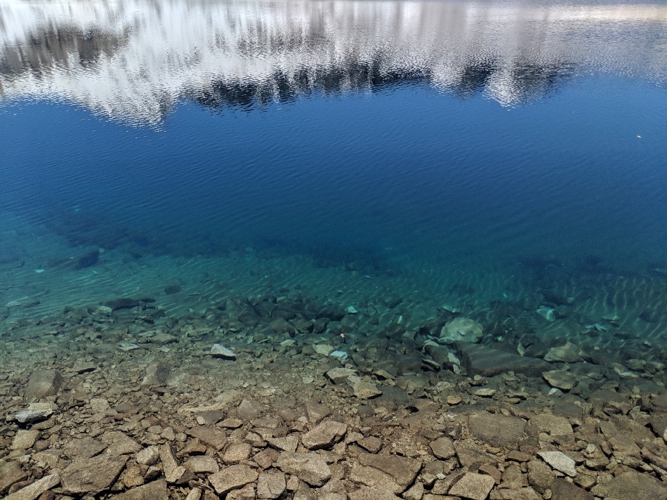
Forrester Pass, the highest point on the PCT, is the first of the passes in the Sierra range. On the way up, the approach was mostly easy, even as you got above tree line. At one point, the trail was blanketed in snow to the point you couldn't find it. There was even a part that might have technically been a glacier. At least, it looked like one due to the hexagonal pattern of cracks, blue in color. It was only the last mile are so, switchbacks all the way to the top, that got difficult.
Reaching the top of the pass was especially satisfying, since at 13,500 ft, no other point on the PCT comes within even 1,000 ft of its elevation. At the summit, I hung out with two Swiss girls, who gave me a piece of chocolate. We talked about the differences between the Sierra and the Alps. The Alps, it seems, are just as pretty, but more civilized, complete with towns and cable cars. I decided to head down before they did.
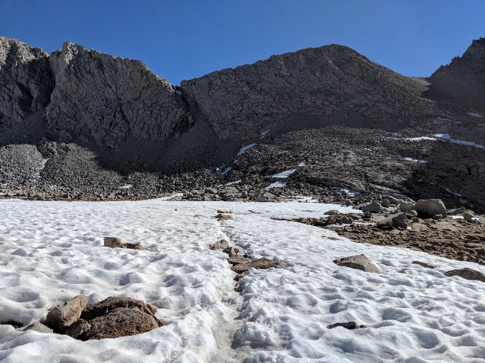
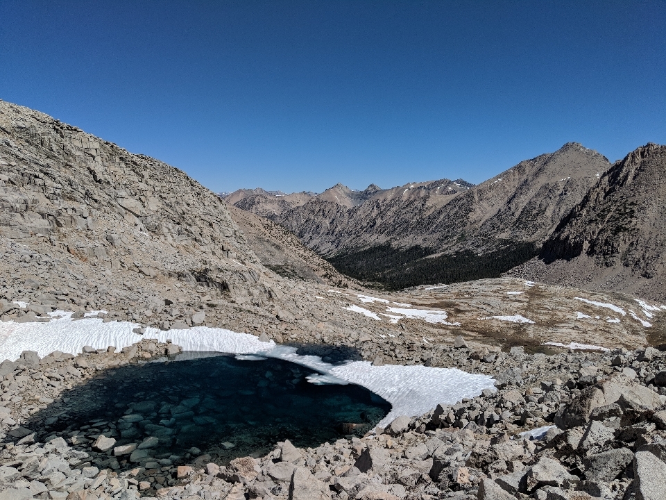
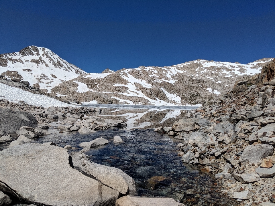
From the pass, there was no way of discerning where the trail was. The entire northern slope was a white sheet. The closest thing to a trail were three or four grooves in the snow where people had butt-slid their way down. With few other options, I did the same, even though I was scared of going too fast, losing control, and sliding onto the rocks below. To this Texas boy, snow is this thing I've heard about, and it behaves unpredictably. I don't know how to handle it.

The butt slide was faster than I would've liked, but effective. After that, the trail became noticeable, but you still had to hike through snow repeatedly. Snow bothers me more than any other trail condition. More than hills by a long shot. When you're hiking up a big hill, you can grunt a few times, put in a little more effort, and keep going. Snow decides you're not going for a hike today. Instead, you get to stumble like an idiot and slow down to a crawl, no matter how much effort you put in.
After the pass, naturally there was a long descent, and then another pass, the steepest on the PCT. I decided to take it on the same afternoon.
Glen Pass was one I'd previously done on a random solo backpacking trip years before. I certainly remembered it being difficult, but at the time, I lived at sea level. Now that I was altitude-adjusted, perhaps it would be easier?
It was still pretty damn hard. Fortunately, there was less snow than on the prior hike, when I described the descent on the northern face as two hours of hell. Despite having microspikes. This time, I had no such equipment, and it was easier, but the snow was still obnoxious.
It looked like after the pass, there would be a nice steady downhill, and it could have been, if not for the rocks. The trail was completely inundated with them. You could have really gotten going if it wasn't for that.
I made it to where the trail bottomed out just as it was getting dark. They were a bunch of other hikers there, as well as a bear box.
Inside the bear box, there were food bags, as you'd expect. Unexpectedly, they were also a pair of hiking boots and trail running shoes. I was supposed to get new shoes in Kennedy Meadows, but when my package was lost, I never got them. I looked at the shoes in the box. They were my size.
I walked around the camping area and asked if anybody knew what was the deal with the shoes. They didn't seem to belong to anyone, and one group said the shoes were there when they arrived, before anyone else. It looked like they were up for grabs. I tried them on for the remainder of the evening. For the most part, they felt good, and they looked like they only had about 100 miles on them. I left my old shoes in the bear box and picked these up to wear from here on out. What the shoes were doing in a bear box in the middle of nowhere, I had no idea. I tried to imagine the story that led to their presence. Who wore them in, what made them decide to leave them behind, and what were they wearing as they left?
I've been playing this game recently where you try to do as much of your morning routine as possible without getting out of your sleeping bag. I've gotten to the point that I can do about 20 minutes worth of stuff with the sleeping bag at least still on my waist. I don't like the cold.
Through the section of trail with all the passes, I was hiking off and on with two guys names Matt and Austin. Rob, Matt, and Austin, what a fitting trio (my family will understand). I was the only one who had a trail name, though within a day, Matt had gotten "Freak Out" suggested, and later, I would suggest "Strider." For about four days, we saw each other routinely. We didn't hike together often, but would see each other throughout the day while we were stopped for a break, and would do almost the exact same mileage each day. I never hiked with Austin at all, but hikeh with Matt a few times, even though his pace was clearly faster than mine, largely because he was about 6'3" with legs up to his face. Eventually, after four days, he would leave me in the dust. Austin I simply lost track of.
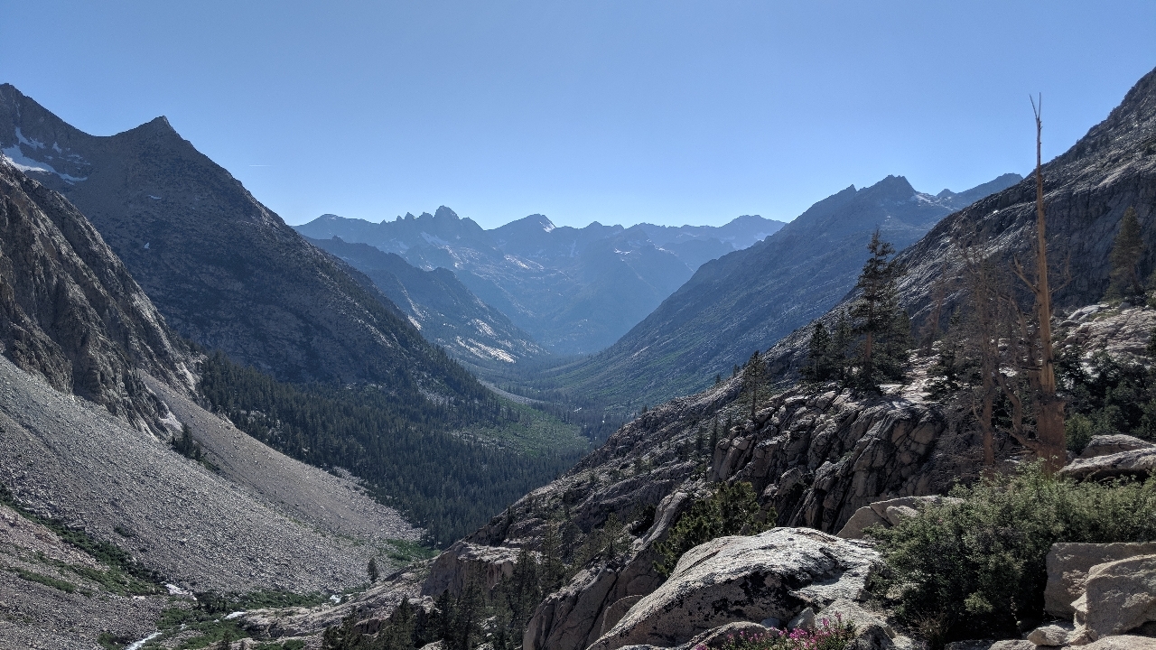
After Forrester Pass, the highest pass on the PCT, and Glen pass, the steepest pass on the PCT, I figured all the rest of the passes would be easy by comparison. As far as climbing goes, they they were certainly easier, but no easier overall. What made the passes difficult was not climbing, not elevation, but snow. The snow I loathe so much.
A lot of hikers walk with earbuds in, so they don't notice when you catch up and get stuck behind them, not even when you deliberately start whacking your trekking poles on every rock you see. So you're forced to call out to them like some kind of jerk. I typically say, "Good morning!" or "Good afternoon!" but it'd be better not to have to say anything at all. Besides, if you hike with earbuds in all the time, you're not getting the full experience. You're missing out on the sounds of the forest: the bird calls that change based on time of day, the bubbling streams, the wind whooshing through the trees, the mosquitoes buzzing past your ear (OK, maybe missing that last one would be welcome). It almost feels like some people are trying to pretend they're not here.
At the top of the passes, there's always a group of hikers. Sometimes two or three, sometimes nearly a dozen. One morning, within a larger gathering, there were a few people smoking, one person raving about their coffee, complete with cream and sugar, and another switching from her uphill to her downhill playlist. If you go to the trouble of bringing things like cigarettes, luxury coffee, and uphill and downhill playlists out here, you're missing one of the biggest lessons to learn from an experience like this: Don't think about how much you need, think about how little. Sometimes I wonder why people like that are on the trail at all. It seems they'd be happier in a city, sitting in a coffee shop with earbuds in, smoking a cigarette and listening to their favorite playlist. Ironically, the people who change the least are the most likely to describe the experience as life-changing.
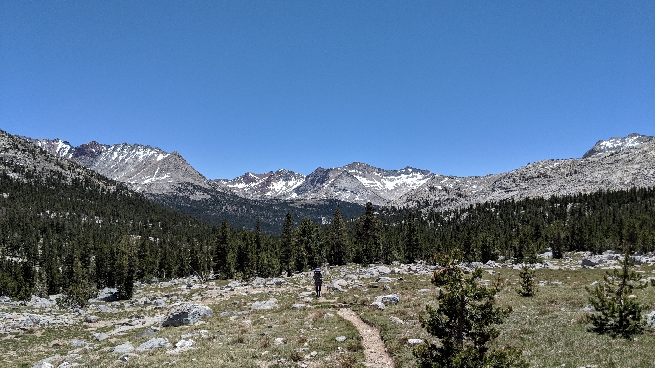
On the way down Mather Pass, the trail deteriorated to a pathetic state of maintenance. The "trail" was rocks nearly everywhere, and where it wasn't, it was mud. It was about on par with a bad section of the AT, which is not a compliment. Why was this particular section of trail so bad? Why couldn't anyone come out here and do some maintenance? After a few miles of hiking, I finally realized exactly why this particular section of it was bad: we hadn't crossed a road, paved or unpaved, in over 100 miles, and it would be over 100 miles more before we saw the next one. Any kind of trail maintenance would have to be done after carrying the the equipment a very long way. Only under these circumstances is the trail maintenance comparable to the AT, where the roads are only four miles apart, the hills aren't even half as high, the nearby population is more than twice the size, and the governing body has more than twice the budget. People on the east coast must be afraid of getting their fingernails dirty.
I still managed to cross two passes per day, until Muir Pass, which was so long and gradual even a 25-mile day would still be a one-pass day. You would think that would make Muir Pass the easiest, but it was the worst for one reason: snow. Of course.
One of my least favorite things about the snow is how much people lie about it. On the way up to every pass, I'd ask southbound JMT hikers how much snow was there. if they said there was "no snow," I would ask you again, and then they would say they're were two or three avoidable patches. What that inevitably meant was the trail was completely obscured by the snow, to the point of invisibility. You had your choice of constantly post-holing or going bouldering down the mountain. I usually chose the latter. I didn't like it.
The record goes to the group of three guys who all insisted there was "no snow," after which I found snow 30 seconds later. I don't know how anyone has the gall to say there's "no snow" when they just hiked over it. You'd think you were in Latin America and you asked what time something would happen. It's enough to make you wonder if the JMT hikers got together and agreed to play a joke on the PCT hikers.
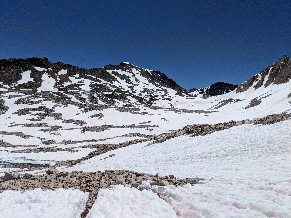
Muir Pass was the only pass for which I was adequately warned about the snow. Some hikers had claimed there were as many as three straight miles of sloshing. That was accurate, for once. Combining both sides of the pass added up to about that amount. That said, it wasn't as bad as I thought it could have been, because people had tramped down a path of hard pack through the snow. As long as you followed others' footsteps, you could hold a respectable pace. At least where that was true.
In some places, you could neither find the trail nor a place where people had tracked a path through the snow. At those times, you simply had to guess where you thought the trail was and walk in that direction. Eventually, you'd find it. Whenever I found a section of trail as it emerged from the snow, I kicked the crap out of the last mound of snow, thereby clearing another half-meter of trail. Whatever I can do to help my fellow hikers. If every hiker did this, we'd have the trail clear in a week or two.
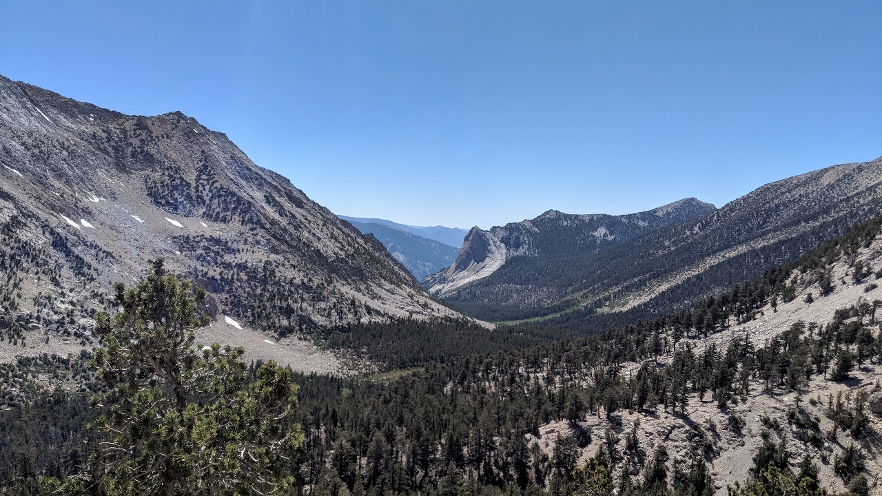
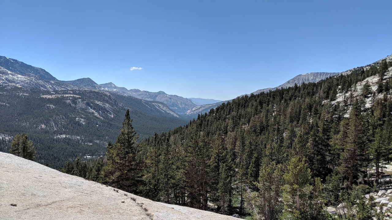
On the way down Muir Pass, we found ourselves in a beautiful green valley, reminiscent of Yosemite. When people decide to hike the PCT, this is the hiking they have in mind: under the trees, beautiful scenery, and easy walking. With the last of the 12,000-ft passes behind us, it felt as if this was it from here on out. We'd paid our dues and now we had it made.


 June
June

