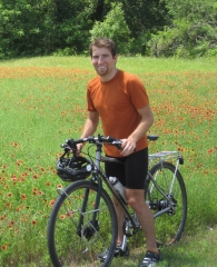
Tanner
Lord I know the struggle with Chipseal, but keep killin it!
Jul 13, 2017
Lord I know the struggle with Chipseal, but keep killin it!
Jul 13, 2017
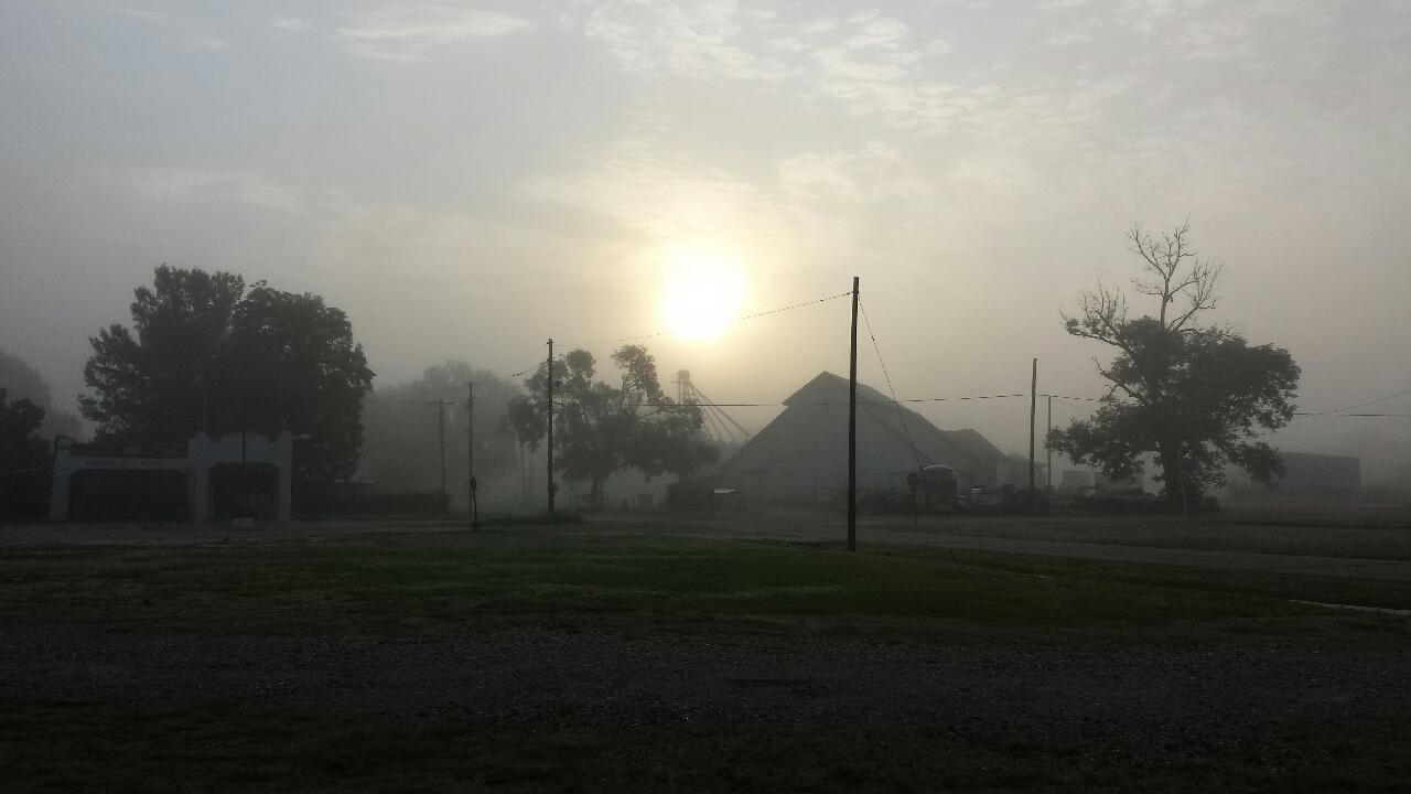
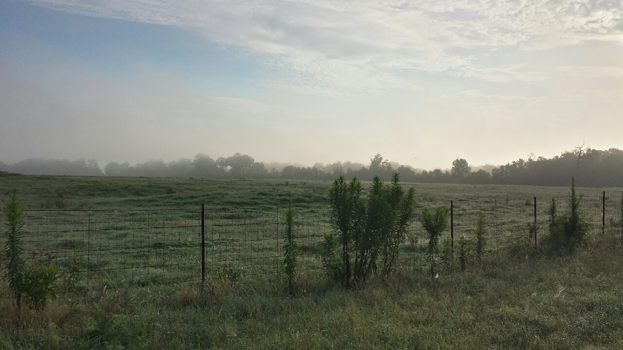
The morning I left Arkansas, first fog of the tour. It hurts visibility, but gives the world a certain magical quality.
I impulsively changed my intended route when I saw a sign pointing down a county road, calling it a "Scenic Bike Route". A glance at the map showed it would go the same place eventually and cover no more distance, perhaps less. Sounds good!
I should've been able to predict that less than half of it would be paved. The second half, of course, except for the last half-km before getting out to a main road. It's important that people can't tell they're going to be on a terrible road until after it's no longer worth it to turn around.
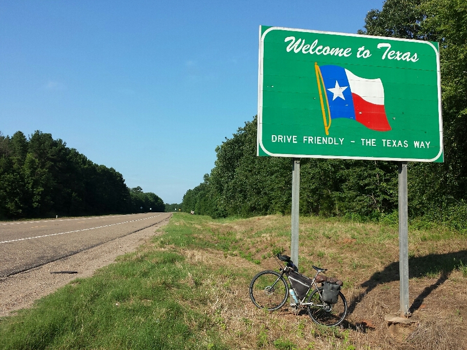
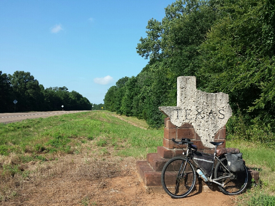
Shortly after rejoining the main road, crossed the Red River back into the Lone Star State. No matter how long you've been gone, what kind of trip, or how you get there, it always feels good when you're back in Texas.
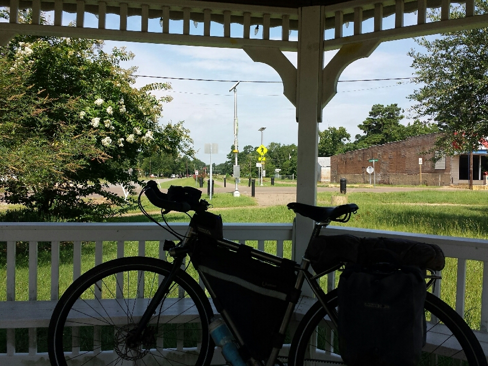
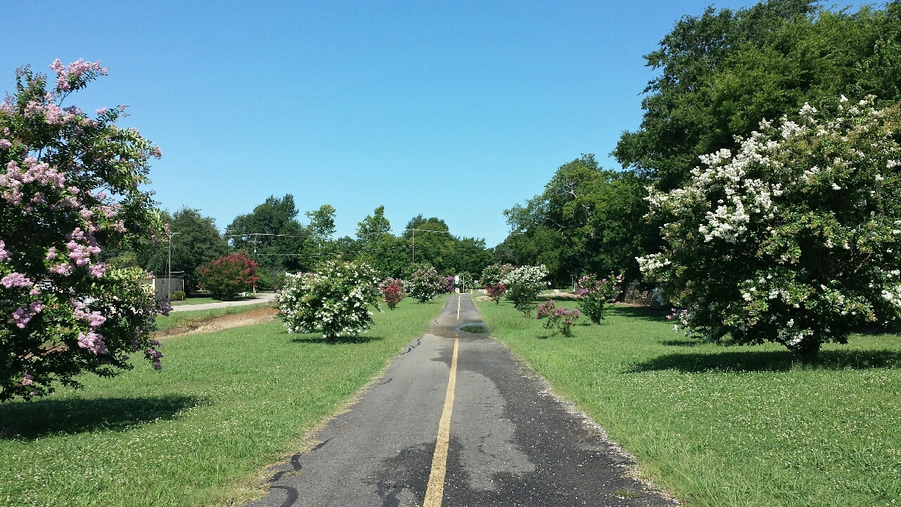
It wasn't much longer before arrival in New Boston, the eastern terminus of the Northeast Texas Trail. Found the trailhead, marked by a gazebo, and jumped onto a paved trail, landscaped with crepe myrtles. Once they're fully grown, it'll be a beautiful start/finish to the trail, almost like an arch of flowers.
One km later, the trail disappeared. It reached a cross street and stopped.
Where'd it go? Oh, maybe it's on the other side of the road.
I crossed the road and looked around. Nope, not there either. I went back. Maybe it dog-legged somehow? No...I looked straight again. I saw a patch of dirt.
No, couldn't be...
The Northeast Texas Trails Coalition clearly states that the trail isn't complete, but this was supposed to be one of the best sections, among the only sections suitable for biking. It was a natural dirt surface with patches of tall grass only outnumbered by the mudholes. It would barely qualify as a hiking trail. In no way was it a biking trail. I got back on the highway.
As a hiking trail, the NETT fails, because it mostly parallels US 82. You don't go hiking because you enjoy listening to shipping trucks. And it's not even in the shade. You might as well be walking on the highway. As a biking trail, it fails because the surface is terrible. The trail might as well not be there.
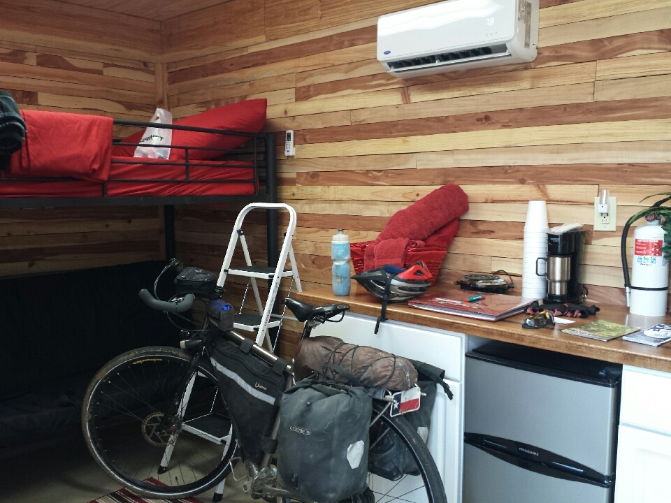
Movin' easy on a loud-but-well-maintained highway, I arrived in Avery before 1:00 PM and let myself into the firehouse hostel. Called Gary, the firefighter in charge of it, and let him know everything was fine, and by the end of the phone call, I was invited to dinner.
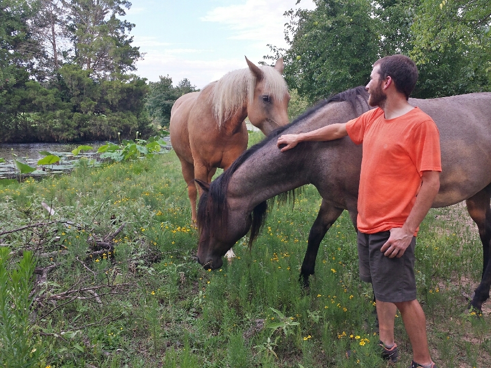
Gary picked me up around 4:00 PM and took me to his place, 8 km south of town, where he and his wife Jimmy grilled burgers, complimented by beer and ice cream. Two of their dogs, Rat and Socks, appeared to like me (especially Socks), but Freckles didn't. After dinner, we went out and fed the horses, named Runnin' Jazzy Hot, and unbelievably, Valeria.
The plan was to camp in Ladonia the following night, then finish the ride the next day. I stayed off the trail until just outside of Paris, based on the description of the conditions. In places where county roads crossed the trail, I was dumbstruck. There's not anything that could reasonably be described as a trail. There's barely a clear-cut. There's no kind of path at all, and the undergrowth is about as tall as I am. The only way through is with a machete and/or chainsaw.
Outside of Paris, the trail went from non-existent to near-perfect. Separated from roads, quiet, wooded, paved. Some parts of the pavement weren't great, but it improved the closer you got to Paris. Park benches every 500 m. LOTS of people outside, riding bikes, walking, jogging. It's almost like people want these things to be built, and when they get built, they get put to good use.
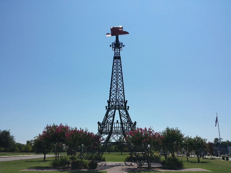
Had to backtrack to see the Eiffel Tower, then got outta Paris. The route turned southwest just as the afternoon's wind picked up, out of the south. The trail became unusable again, so back onto county roads. It wasn't even noon yet. I'd get to Farmersville before 6:00 PM, and Plano was three hours past that, maximum. Would it be possible to finish the ride today?
I'd nearly forgotten how bad Texas's roads are. With the exception of freeways and city streets, Texas exclusively uses chip seal. If you don't know what that is, it's when you take a bunch of rocks and Elmer's Glue and call it a "road". There are unpaved roads in much better condition. There are hiking trails (like the Katy Trail) in much better condition.
For a state with a barely contained amount of pride, that takes itself seriously, that considers itself tough and hard-working, this is an embarassment. If you want to look like you finish what you start and put some effort into your work, build better roads. If you want to look like a cheap, lazy bum, keep using chip seal. Yes, Texas, I'm attacking your pride. I'm confident everyone in the state would be willing to chip in an extra $5/year for a few years if it meant our roads drastically improved, and it would come back to most of us by means of improved gas mileage. But you know what the politicians are thinking, "They want a road? Fine, give them a road, the cheapest way possible. Unless it's a major city or a freeway, because those people matter. But if you live in the country, screw you."
Other states don't have this problem; only Texas. C'mon guys, let's stop getting embarrassed by everyone else.
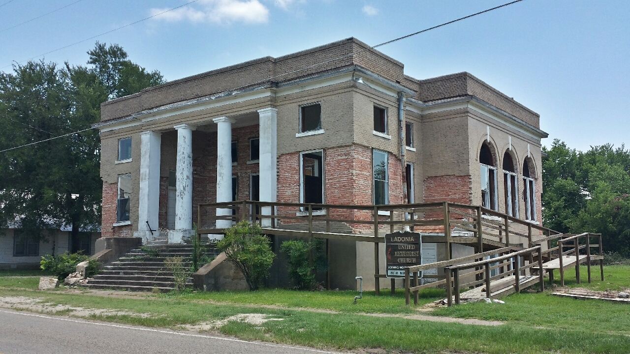
I arrived in Ladonia, the original destination, at 2:30 PM. It was hot. Pitching a tent and sitting around for several hours seemed pointless, unless there was a really cool place to camp. I was nearly out of water. That would be priority #1. Didn't see a gas station, so I headed over to the post office. They'd help me out.
It was closed, at 2:30 PM on a Monday. There was a sign on the door stating that Ladonia had a water boiling ordinance.
Well, that settles it. Not camping here.
I still needed water, though. A gas station would still help, but I'd have to buy water, rather than asking for it from a tap. That'd be fine if there were a gas station. I went over to the town square, looking for any business that might be open have have a cooler of Cokes in the back. Found a mom-and-pop antique store, but like any good business in a small town, it was closed. But outside, there was a vending machine! Soda wouldn't be the best thing, but maybe it has bottled water, or if I'm lucky, a sport drink. And it did! For $1.75.
Oh, c'monnnn, $1.75?!? That's twice what it normally costs!
With no other good option, I bought one. On my way out of town, I saw a gas station. Dammit!
Wolfe City was where the trail was supposed to get rideable again, and importantly, it made a straight shot southwest, while every county road in the area was either north-south or east-west. I loaded up on water and hit the trail.
Before even leaving town, it became virtually unrideable. It could be done, but it wouldn't be any fun. Loose rocks and mudholes almost everywhere. When it was good, it was kind of fun, but when it was bad, you almost had to come to a complete stop, voluntarily or not, to get through. Back to the county roads, even though it would be several km longer.
Heat, headwind, and chip seal. Heat, headwind, and chip seal. No end to the heat, headwind, and chip seal. Each one of those was probably worth shifting down a gear. I could be moving 30% faster if it wasn't for the heat, headwind, and chip seal. Most frustrating was the chip seal; it doesn't have to be there. We made an obstacle ourselves. It was starting to look like I wasn't getting to Plano today.
Unfortunately, the dogs hadn't gotten much better since Arkansas. After being chased by one, the owner, who was outside, called, "Sorry!"
No, you're not. If you were sorry, you'd do something about it. Like a fence. Or a leash. Or keep it inside. Or train it.
If people won't train their own dogs, from now on, I will. With pepper spray.
The last 7 km of the trail, like the first km and the 15 km outside of paris, are in great condition. Half of it was comparable to the Katy Trail, and the other half was paved. I prefer the gravel surface, as long as it's well-maintained, because it feels more like a trail, and it's a lot better for hiking and running. This is what the entire trail should've been like. 90% of the work is still to be done. But it's understandable why these towns of < 1,000 residents don't make a hiking/biking trail a top spending priority. Looking around at the state of these towns can be depressing. Ladonia doesn't even have clean drinking water, and they're supposed to spend money on a hiking/biking trail?
As a result of heat, headwind, chip seal, and frequent re-routing, it was 6:30 PM when I got to Farmersville. I simply didn't feel like camping here and riding only a couple hours tomorrow. I called my parents.
"You got any leftovers or anything?"
"Yeah..."
"I'm coming."
It wasn't until about 5 km from their house that I needed lights, but I still put them on 10 km away just because. If cars didn't exist, I wouldn't have bothered. It never quite got all the way dark, but certainly dark enough that all the cars were using their lights, so I better use mine too.
At 9:00 PM, 14 and a half hours after I'd started, I arrived in Plano, tour complete. The longest day of the tour and second-longest ride I've ever done, only behind a day in Argentina with a lot of steady decline and a rockin' tailwind. I walked inside, stood in the kitchen scarfing down a leftover hamburger, then had a shower.
Conclusion to follow...
Read about Coyote's adventure with his father in Central Texas. Music, food, wheels, family, all the finer things in life.
 2006
2006
 June
July
August
2007
February
2008
October
November
December
2009
January
February
April
June
June
July
August
2007
February
2008
October
November
December
2009
January
February
April
June
 Lampasas, TX
Lake Whitney State Park, TX
Cedar Hill State Park, TX
Plano, TX
Denton, TX
Archer City, TX
Quanah, TX
Clarendon, TX
Palo Duro Canyon and Amarillo, TX
Dalhart, TX
Branson, CO
Rocky Ford, CO
Manitou Springs, CO
Aurora, CO
Fort Collins, CO
Laramie, WY
Rawlins, WY
Rock Springs, WY
Kemmerer, WY
July
August
2011
January
April
2013
February
March
May
June
July
August
September
October
November
December
2014
January
February
March
May
June
July
August
September
October
November
December
2015
October
2016
2017
January
April
May
June
July
August
September
October
December
2018
January
February
March
April
May
June
July
September
October
November
December
2019
January
February
March
April
May
June
July
2020
February
March
May
June
July
August
September
October
2021
2022
2024
Lampasas, TX
Lake Whitney State Park, TX
Cedar Hill State Park, TX
Plano, TX
Denton, TX
Archer City, TX
Quanah, TX
Clarendon, TX
Palo Duro Canyon and Amarillo, TX
Dalhart, TX
Branson, CO
Rocky Ford, CO
Manitou Springs, CO
Aurora, CO
Fort Collins, CO
Laramie, WY
Rawlins, WY
Rock Springs, WY
Kemmerer, WY
July
August
2011
January
April
2013
February
March
May
June
July
August
September
October
November
December
2014
January
February
March
May
June
July
August
September
October
November
December
2015
October
2016
2017
January
April
May
June
July
August
September
October
December
2018
January
February
March
April
May
June
July
September
October
November
December
2019
January
February
March
April
May
June
July
2020
February
March
May
June
July
August
September
October
2021
2022
2024

