Leaving Kennedy Meadows the same day I arrived, I managed to get seven miles under my belt before dark. I camped with Sam and Connor, two good friends who were hiking together. They where both from Duke University. I suggested the collective name "The Two Devils."
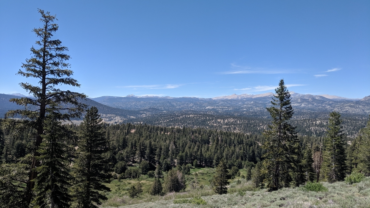
A lot of climbing the next day. At around noon, you could look across a wide valley and see snow-capped peaks in the distance. One of them stuck out. I wondered if it was Mt. Whitney. If so, impressive that you could see it from two days away.
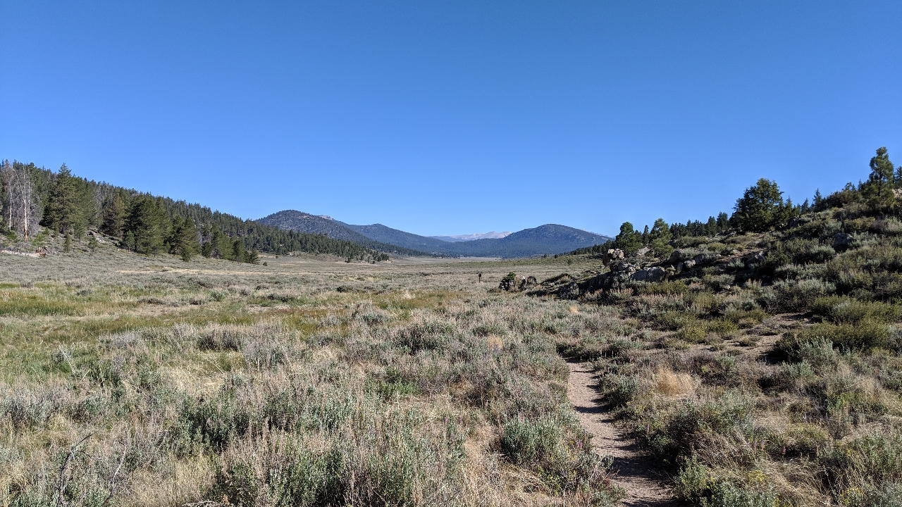
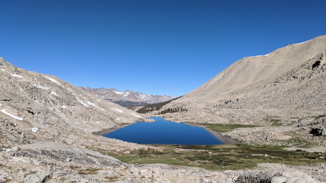
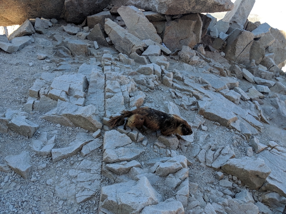
There's something magical about the Sierra. Even the sky looks different there. Suddenly, we were somewhere else entirely. Pine trees. Marmots. And the forest sounded different too.
For a while, I was leapfrogging a German guy named Sunshine. At first, I figured he got the name from his bright orange shirt, but it turns out it's because he smiles a lot. That made even more sense. I like it when someone has a trail name that reflects on their personality.
At some point, I was hiking with two guys from Canada. They were out for a day hike and were planning to summit Whitney the next day, the same as myself, only they'd be coming from the other side. For some reason, we spent a lot of time talking about football, comparing American to Canadian, and the following it gets in Texas and Saskatchewan.
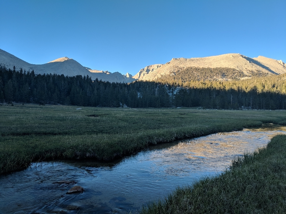
Even two days away, the name "Whitney" hung in the air. Reaching the summit was on everybody's mind, and we were each coming up with our own plans as far as how to attack the mountain. Some people had the idea to wake up at midnight and hike to the summit to watch the sunrise. Whitney sounded hard enough already without doing it in the dark. I might get up at sunrise, but like hell I was hiking at that altitude in the cold and the dark.
Instead, I camped at the trailhead for Mount Whitney and started up first thing in the morning. One mile into the hike, there was a ranger station where you could leave a lot of your belongings. That was a game-changer. With my pack down to half its normal weight, the hike up to Mount Whitney would be more manageable.
Since the Mount Whitney Trail is not part of the PCT, I didn't have an elevation profile. Obviously, I knew there would be a lot of climbing, and that it would essentially be all uphill to the summit and all downhill on the way back. However, I had no idea where the steep parts would be.
For the first half of the climb, it wasn't too bad. It was tough in spots, but reasonable overall, even as you got past tree line. After a couple of ponds, the trail shot upwards, with a lot of switchbacks along the way. As a matter of fact, it went the opposite direction I thought it would, because I figured there was no way to ascend that particular face of the mountain. Turns out there is.
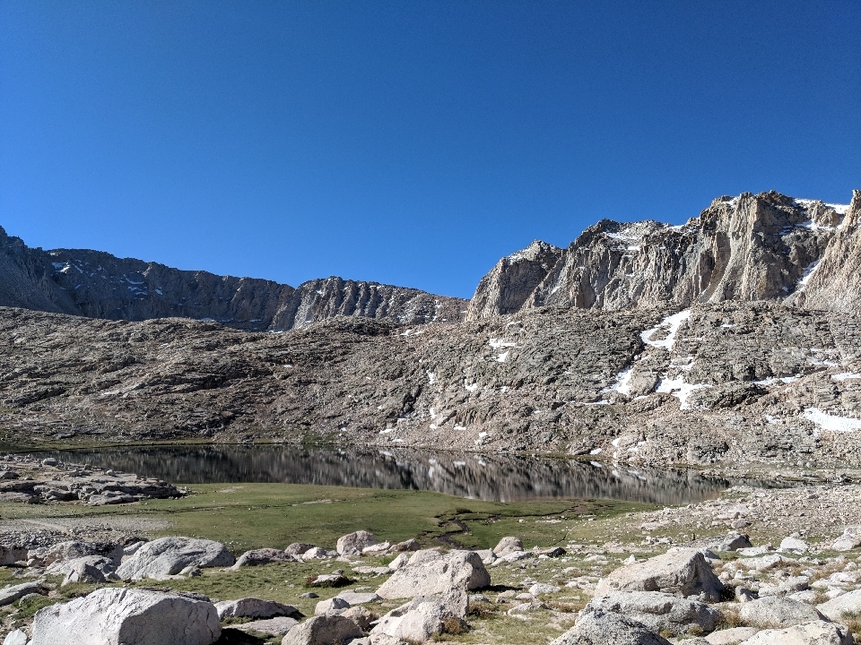
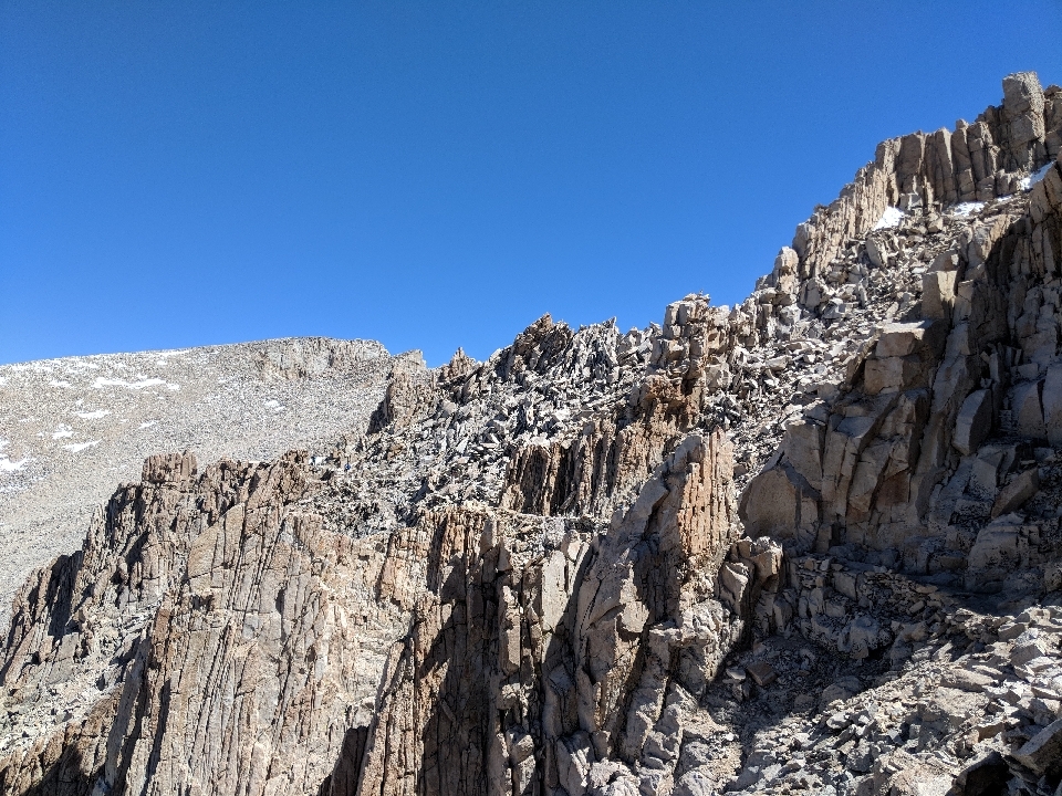
As I looked at the cliff faces around us, they looked impossibly tall. At some point, I realized that by reaching the summit, I would have to climb above them. And everything else.
As it got steep, I started seeing more and more people on their way down. They assured me it didn't stay this steep all the way to the summit, and that it would get easier at the trail junction, two miles shy of the summit. While it was true that the trail got less steep, it got more difficult because it was now entirely made of rock. Here and there, you had to use your hands and scramble over them. With a 1,000-ft drop to your left, this was hardly comforting.
I've always found that elevation doesn't so much make you out of breath, but simply makes you weak. I wasn't panting, nor were my legs aching, but I was simply out of energy. Every ten minutes or so, I would stop to take a break, sometimes one minute, sometimes five. No matter how long the break was, I would feel like Superman for my next ten steps, then immediately revert to my previous pathetic state. This went on for over an hour.
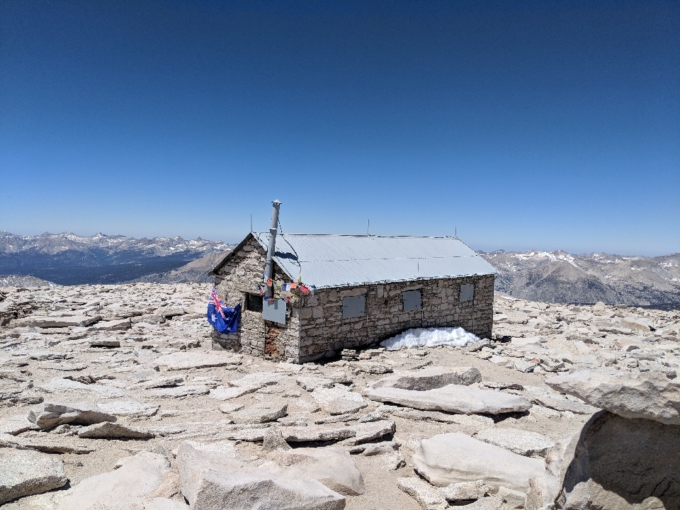
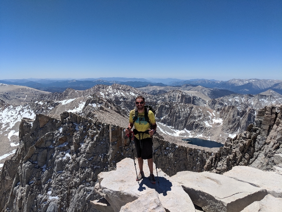
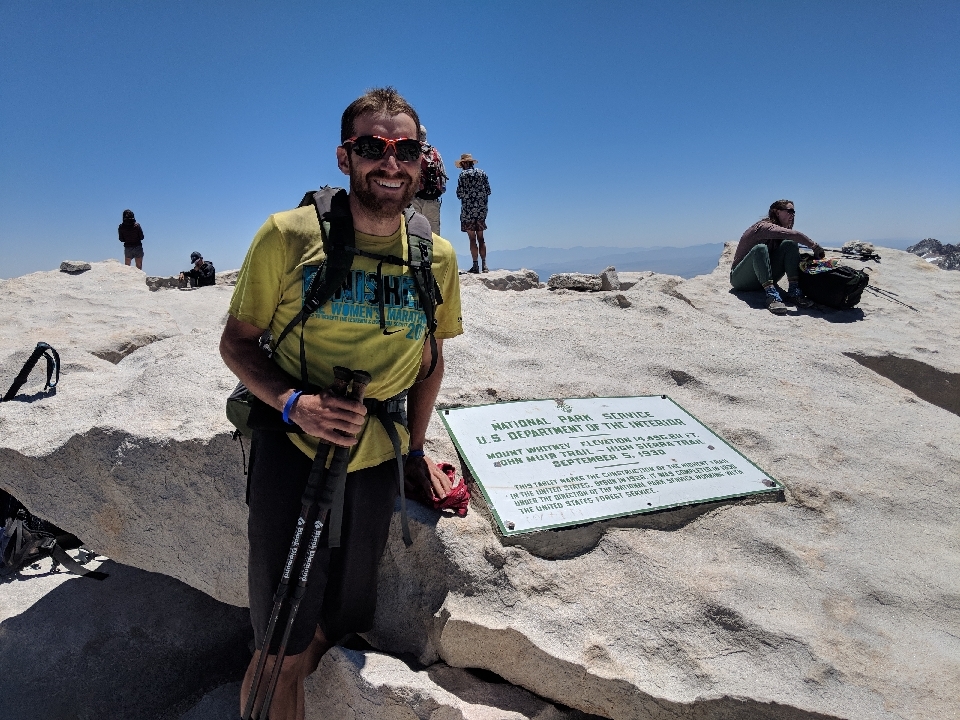
At last, there was one final push uphill, on gravel instead of rocks. Even so, you can't tell you're near the summit until you're essentially there. Once I finally saw the stone hut, less than one minute of hiking in front of me, I raised my trekking poles in triumph.
Since Mount Whitney is a popular day hike, and the PCT also now coincides of with the John Muir Trail, there were a lot of people on betrayal and especially at the summit. Some of them were having lunch, some of them were smoking, some of them were taking pictures. I hung out for about half an hour, had a snack, took some pictures, and headed back down. I wanted my beloved oxygen again.
As soon as I started walking downhill instead of uphill, it was remarkably easy. I suppose the lack of oxygen only matters when you need it, and going downhill, I didn't need nearly as much. The rocky section was still obnoxious.
On the way down, I saw the friendly Canadians, Paul and Ed. They were moving slowly, but they were getting there, and had a good attitude about it. Good to see those guys again.
Once past the rocky section, the entire descent was a snap. I reclaimed my gear at the ranger station, and feeling good, decided to press on at least a few more miles.
For the rest of the day, anytime I went uphill, I got a headache. I suppose my brain hadn't fully recovered from its oxygen deprivation. I simply made it a point to take smaller steps uphill, so as not to strain myself too much. I still manage to crank out seven miles after the 17 miles it took to climb and descend Mt. Whitney. After a good night of sleep, I was fine again.


 June
June

