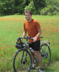
Crossover
After spending two full weeks in Etna, the snow still hadn’t cleared on the trail ahead, but it was time to get moving again. Once more, I stuck out a thumb on the main drag in town. It took about an hour to find a ride, and by the time I got one, another hiker had joined in. We climbed into the back of a pickup and shot the breeze for the entire 30-minute chilly ride. Upon getting dropped off at the trail, we began hiking together, even though neither of us indicated that was the plan. Soon enough, it was evident that we were equally matched on the trail.
Sherpa, who preferred going by his real name, was a recently retired lawyer from Minneapolis. It took two days of hiking before I learned he was married to a man. Evidently his husband was repeatedly driving out from Minneapolis to meet him on the trail, but I wondered why they weren’t simply hiking the trail together.
Sherpa and I not only hiked well together, but got along well. Less than 10% of our time spent hiking was silent; we simply enjoyed each other’s company and chit-chatted nonstop. As it happened, we were planning to get to Ashland on the same date, so it only made sense for us to stick together at least until then.
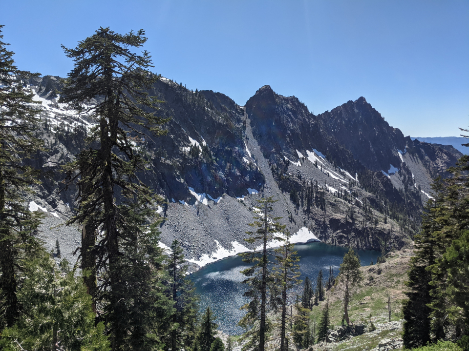
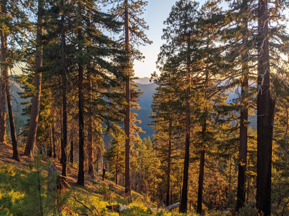
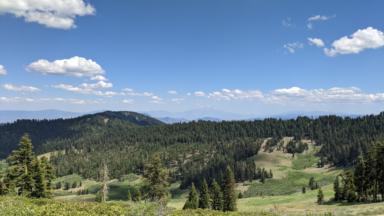
The Russian Wilderness, near Etna, is one of the unexpected highlights of the PCT. It isn’t quite as large and epic as the Sierra Range, but I submit the terrain is equally dramatic. The lingering snow only added to that. Half of the dialogue between Sherpa and myself was simply about how much we were enjoying the hike and the views.
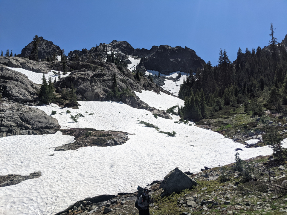
The weather was consistently sunny and warm, and as a result, the snow was melting rapidly. At times, we had to walk across it, and at other times, walked across impromptu waterfalls that would probably be gone in a week or two. The mountains appeared to be weeping.
My typical dinner routine involves eating a few miles before arriving at camp. That way, you don’t eat where you camp, which keeps your campsite odor-free and keeps animals away. Furthermore, the meal gives you a little extra oomph for the last few miles.
Sherpa, like most hikers, preferred to set up camp and then have dinner. There’s a logic behind that, since you get to take your time, relax, and enjoy dinner, now that all of the day’s work is done. On our first day hiking together, we had dinner separately, but after that, I started having dinner his way.
There’s something about sharing a meal with others that’s fundamental to the human experience. Nearly every religion finds something sacred in the tradition. On a personal level, I almost never eat at restaurants because I don’t want to be seen eating alone. If I have to change a habit in order to gain companionship and participate in a millennia-old human tradition, so be it.
Beginning in Etna, and again in Seiad Valley, we saw State of Jefferson flags. Several communities in Northern California and Southern Oregon feel as if their local values don’t align with those of their state, and as a result, there’s a movement to secede and form their own state. Others in Oregon simply want to become part of Idaho.
Some of the complaints have a fair point: They pay the same high tax rates as everyone else in the state, but rural communities always get left behind when it comes to services and infrastructure. But I’ll simply point out that in states that are majority red, like my home state of Texas, the blue parts never threaten to secede.
On both sides of Etna, the trail had a lot of downed trees, and on the way down to Seiad Valley, it was completely overgrown. You were essentially shoving your way through the brush for over a mile, often guessing where the trail is supposed to be. I was only praying that none of it was poison oak. The downed trees weren’t gone, either.
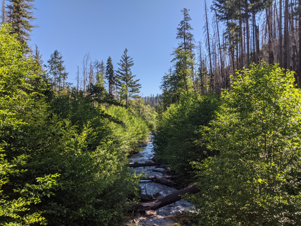
At some point, the brush finally stopped, and the trail opened up dramatically. As it turns out, a group of hikers from Washington came down to clear as much trail as they could. This section of trail was so notoriously bad, people drove hundreds of miles from home to fix it. For free.
People in Northern California need to get off their butts and take care of their trail. The same goes for more than half of the Appalachian Trail, and since that’s in a heavily-populated part of the country, they have no excuse.
As the name suggests, getting into and out of Seiad Valley involves a long descent, followed by one of the largest sustained climbs on the trail: 4,000 feet of climbing in a span of six miles. That’s roughly a 12% grade - enough to make many cyclists get off and walk. And that’s on average, meaning half the time the hill is even steeper.
More directly, Seiad Valley is sandwiched on both sides by a long road walk. Normally, this wouldn’t bother me, but the valley itself is hot. Low elevation at midsummer, in a dry area, and the surrounding hills only trap the heat, for an oven-like effect. Add to that the heat reflecting off the pavement and you’ve got a miserable few hours of walking.
Sherpa and I made the walk into town before noon, and it was still exhausting. We both agreed that we’d hang out in town for several hours, then hit the road sometime between 5:00 and 6:00 PM, once the sun had started working its way down. There isn’t much in Seiad Valley aside from a cafe and a general store, each occupying one-half of the same building. We headed there.
Once inside the cafe, it took 45 minutes before anyone approached our table. It appeared there was only one person working there. We were eventually joined by another hiker, and all three of us ordered large cheeseburgers. Mine was gone in a matter of minutes. I guess I was hungry
Sherpa needed to resupply at the store, and while he was at it, bought himself a slushie. Feeling generous, I suppose, he asked what I’d like. I chose an It’s-It, probably the best packaged ice frozen treat. Ice cream, soft chewy cookies, chocolate coating, what more could you ask for?
Sherpa and I somewhat reluctantly headed back onto the road for another hour of walking, then started up the hill with two hours of daylight remaining. Road walks and climbs make you feel hot, so our idea was to tackle the road walk and the first part of the hill in the evening, while the sun wasn’t beating down. Furthermore, we could split up the climb by hiking half of it now, camping in the middle, and finishing the 2nd half in the morning, rather than doing the entire climb in one grueling stretch. Both the evening climb and the 2nd half in the morning were tough, but not insurmountable, so it wound up being a good idea.
Not only did the next day start with a tough climb, but there was another nasty climb in early afternoon, just as the day got rather hot, and in an area with no shade. I was able to push through it at pace, but had to wait on Sherpa a few times. He’s noticeably better on tricky terrain and other obstacles, but I’m better when it comes to pure athleticism.
It was becoming clear that we could’ve easily made it from Etna to Ashland in only seven days instead of eight, but both of us had a reason to stick to the eight-day plan. I had already made reservations at a hostel in Ashland, and Sherpa was meeting some friends there. As such, we took longer and longer breaks, and also finished hiking in late afternoon.
Each day after Seiad Valley was a little easier than the one before, to the point that it almost became a challenge to fill the hours while staying on pace to arrive in Ashland on July 3rd. One day, near lunchtime, we found a cabin only a few miles shy of the CA/OR border. It was warm out, so we sat inside in the shade for lunch. Then I fell asleep in a canvas chair for about an hour.
Crossing the CA/OR border is a monumental point in most PCT thru-hikes. 64% of the PCT (nearly two-thirds) is in California, including many of the most difficult sections. Once hikers make it here, they’ve probably been on the trail for three months already. At that point, you start to realize that you’re really going to make it (as only one-sixth of thru-hikers do). If you were to hike the same amount of miles on the AT, you’d be more than 75% done, and you’d be in New Hampshire.
Sherpa had skipped the Sierra, intending to flip back down and finish them later, and I’d only started hiking a few hundred miles ago, having done the first 1,420 miles another summer. As a result, the moment didn’t seem as big to either of us, but it was still photo-worthy.
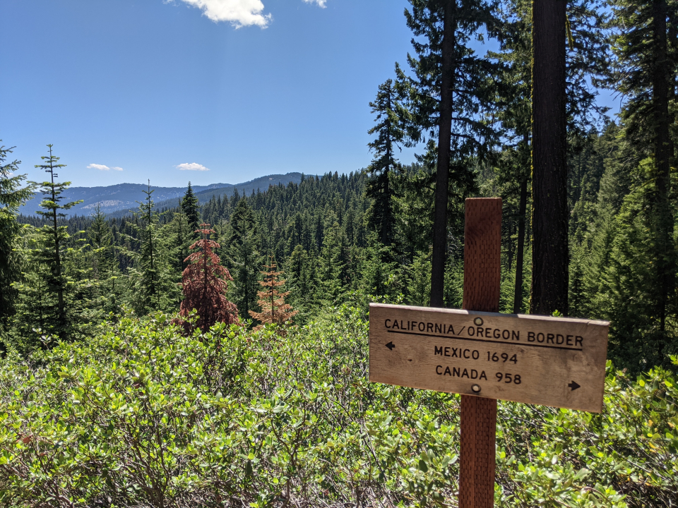
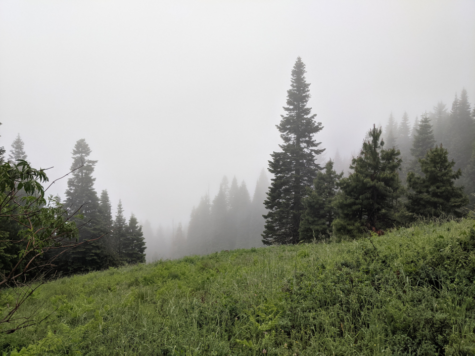
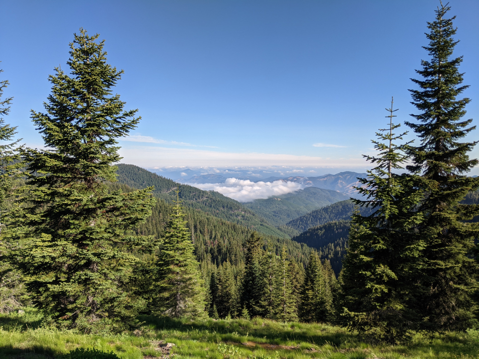
State borders are often little more than arbitrary lines drawn by humans, especially the ones that are straight lines. All the same, it always feels different when you cross one. Within a day, we saw the first fog I’d seen all summer, and later the same day, it rained. Welcome to Oregon! The trail was also kept in notably better condition, and as a result, the miles melted away quicker.
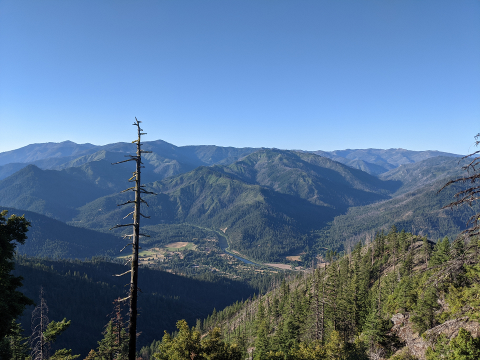
We could still see Mount Shasta from Oregon, after first seeing it more than 300 miles ago. It’s a big mountain.
Sherpa and I both noted that the trail in this area was more heavily populated than anywhere else. It happened to be a Saturday, and Ashland is evidently full of outdoorsy people. Most everyone we met was a local, out for a hike or a jog. I liked the town already, and hadn’t even made it there yet.
In the preceding days, I’d mentioned a distinct lack of Trail Magic this summer, and chalked it up to the fact that I was far ahead of “the bubble” (the majority of hikers), and therefore, people weren’t doing Trail Magic until more hikers would be around to enjoy it. But a few miles past the CA/OR border, there was a cooler full of cokes, with a single beer. Sherpa and I split the beer and each took a coke as well. I went for a cream soda, while Sherpa opted for a cherry coke.
From that spot, it was all downhill until we got to I-5, from which you hitchhike into Ashland. At the highway, there’s an outdoors store named Calahan’s which allows hikers to camp for free. Until recent years, they also provided free showers. We considered staying there, but decided not to, since there were good campsites a few miles short of that, and there was a forecast for rain in the afternoon. We wanted to get our tents up before it started.
After finding a good flat spot in mid-afternoon, we set up the tents right away, and seeing the clouds darken as the wind picked up, we both decided it would be a good idea to have dinner now, in case it got nasty later. Just as we were wrapping up our meal, the rain began, and moments after we each retired to our tents, the downpour began. The wind roared and lightning struck frequently, as little as a quarter-mile away. Once that was over, it was replaced by hail. If we’d tried making it to Calahan’s, we’d still be hiking in this.
In the morning, there were four more tents nearby. I hadn’t even heard anyone arrive and set up, so they either came in late while I was asleep or set up in the middle of the storm. Sherpa and I both left early, before anyone began stirring, so we never found out.
It was still cloudy and cool outside, and everything about the trail was still wet. By the time we made it to Calahan’s, my clothes were entirely soaked, whether from puddles seeping through my shoes and into my socks, or from brushing past overhanging leaves, all of which were still covered in raindrops.
Upon arrival at Calahan’s, Sherpa called his friend, who agreed to pick up both of us and drop me off at the hostel. It took about half an hour before he arrived. As it turned out, the “hiker camping” was in the grass on a median in the middle of the parking lot, from which you can hear traffic screaming by on the highway. Even if the weather had cooperated, I was glad we hadn't come.
I went to use the bathroom, and found a hiker box inside it! There were enough supplies that I wouldn’t have to buy any food in Ashland. If you’re not picky, you could probably thru-hike the entire PCT while spending less than $100 on food.
Ashland lies in a valley, in a sunnier location than the trail. I was still cold, wet, and filthy when I arrived at the hostel, so the first thing I did was take a hot shower. A long hot shower. I felt much better afterward.
Ashland is a mid-sized town with a charming, walkable downtown, a bike lane on every major road (including a separate path all the way to the next town), a small university, a good public library, a surplus of outdoor activities, a freakin’ Shakespeare festival, and a good public school system. By the time I left, I was asking locals if the high school needed a math teacher. They did, but it’s a little too expensive to live there, and moving out-of-state ruins your pension. If you could transfer your pension from one state to another with no penalty, I’d have filled out an application already.
I arrived on July 3rd, so I naturally took a zero on the 4th of July. Prior to this one, the only 4th of July parades I’d seen had one band, one dance team, and then 30 minutes of honking pickup trucks. This one went on for an hour, and almost none of it was honking trucks! There were multiple bands, multiple dance teams, and most of the other participants were walking (you know, parading), as opposed to waving from the back of an obnoxious loud vehicle. That’s how it’s done.
By the end of the parade, the locals I was seated next to had invited me to their 4th of July barbecue that evening. Don’t mind if I do! Unfortunately, later the same day, they texted to inform me that several members of their family had tested positive for COVID, so they had to un-invite me. Bummer, but understandable. And generous of them to invite me in the first place; they never had to do that at all.
Instead, I joined in a game of kickball at the city park, organized by other hikers at the hostel. I was both the oldest and most sober one there. None of us had played kickball since we were kids, and it turned out to be a perfect choice; it’s the kind of sport where the good ones aren’t that much better than the not-as-good ones, and anyone can play it, at least a little. Basically everyone can kick a ball and run.
Upon returning to the hostel, a 4th of July potluck was underway. Don’t mind if I do! Sausage, burgers, and beer. After an impressive parade and a buoyant game of kickball, it was the capstone on an ideal 4th of July.
I still had a few things to get done, and I’d enjoyed Ashland so much, I decided to stay an extra day. Most notably, I visited the public library to print some maps and trail notes, and I walked to the store to buy a new digital watch (after breaking one and losing another). While there, I bought a giant canister of animal crackers, left them in a bowl for anyone in the hostel to eat, and simply kept the oversize plastic jar. I’d had the idea that something like this would work well as a food storage container (which turned out to be correct!).
I’d planned to go to the Shakespeare festival that night, but as I walked there, it began raining. It was an outdoor theatre. I’m not spending $30 to sit in the rain for two hours. I turned around and walked back to the hostel, where I whipped up a heap of mac and cheese with tri-tip (both left behind by other hikers), and shared it with two English girls, both of whom were fluent in French.


 June
June

